Greymouth Railway Station
The current railway station in Greymouth holds a secret in its very architecture, a detail that speaks to the town's ambition and connection to a bygone era.
Full story unlocks in the tour
 Stewart Nimmo / CC BY 4.0, via Wikimedia Commons
“Where the wild Tasman Sea meets a history forged in gold and coal.”
Not the postcards. The stories even locals don't know — whispered in your ear, right where they happened.
The current railway station in Greymouth holds a secret in its very architecture, a detail that speaks to the town's ambition and connection to a bygone era.
The tragic 1896 Brunner Mine disaster, New Zealand's worst workplace accident, has a chilling detail that foreshadowed the tragedy.
A significant portion of Greymouth's commercial heart is not owned in the conventional sense, but rather held by an entity with deep historical roots.
Discover every secret of Greymouth
Every address, every reveal in full — in your ear, right where it happened.
You pick your stops. You walk. The voice reveals what the others miss.
No tours available yet. Check back soon — we're preparing them.
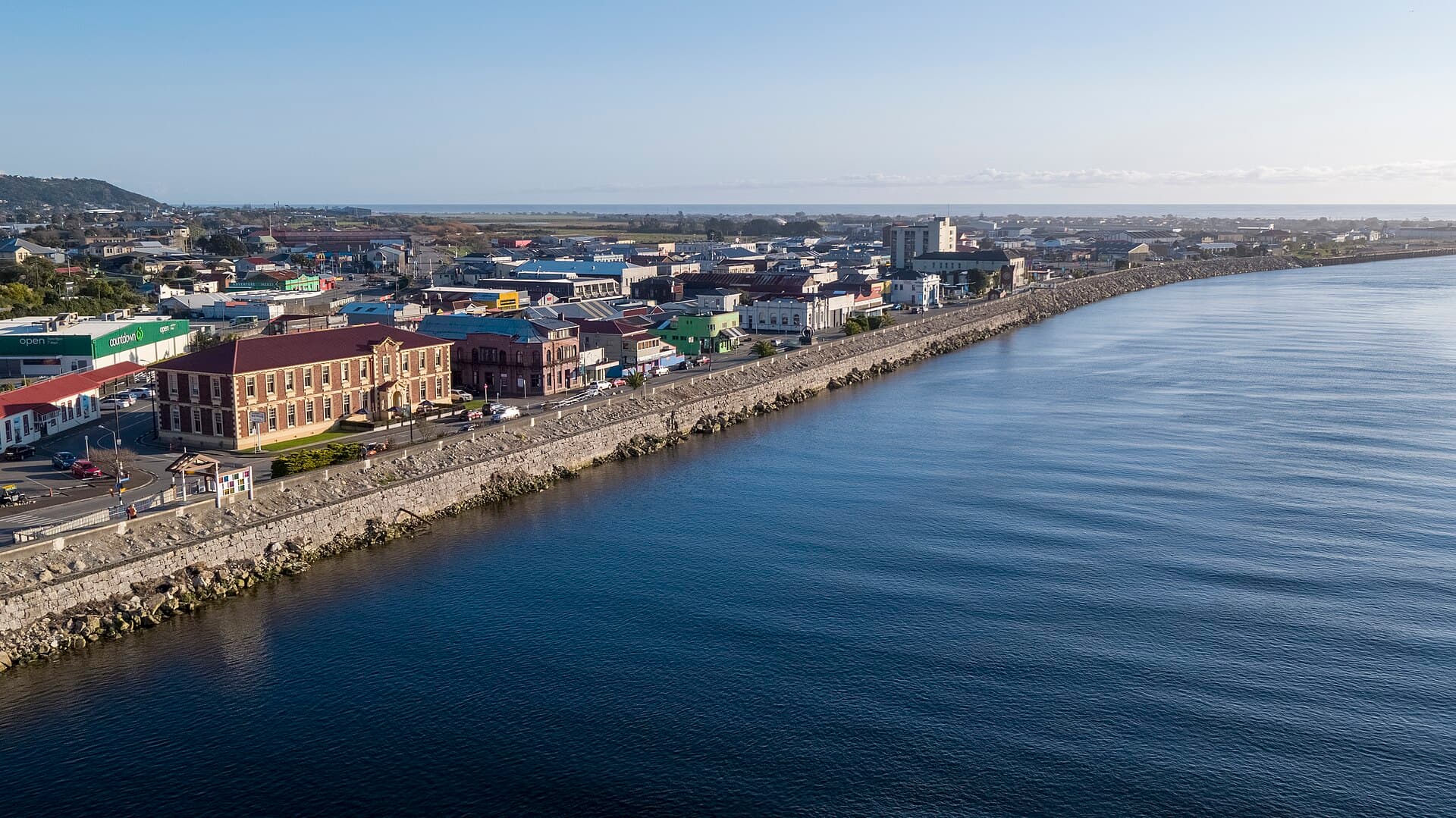
Greymouth, known to Māori as Māwhera, meaning 'wide spread river mouth,' stands as the largest town on New Zealand's South Island West Coast. Positioned where the Grey River meets the Tasman Sea, it acts as a portal to the region's rugged landscapes, from untamed coastlines to dense rainforests. Despite its relatively modest population of around 8,000, Greymouth functions as the administrative and commercial heart of the West Coast.
The town's character is shaped by its deep history, profoundly intertwined with gold rushes, coal mining, and timber. Today, Greymouth offers a more measured rhythm of life, inviting visitors to explore its natural wonders and delve into its past. It is also the terminus of the celebrated TranzAlpine train journey, a scenic five-hour ride from Christchurch across the Southern Alps, considered one of the world's great train routes.
The area now known as Greymouth was originally called Māwhera by the indigenous Māori, a name meaning 'wide river mouth.' A fortified settlement, or pā, existed here, serving as a crucial point on the trade route for the precious pounamu (greenstone or jade). European discovery of the Grey River and its coal seams came in 1846–1848 with explorer Thomas Brunner, who named the river after Governor Sir George Grey.
Greymouth's transformation into a significant settlement was spurred by the 1860s gold rush, which brought a rapid influx of prospectors and established the town as a vital supply and logistics center. Despite the treacherous sandbar at the river's mouth, the port became the primary outlet for exporting resources. As easily accessible gold diminished, the economy shifted towards coal mining, utilizing the high-quality coal Brunner had discovered.
Over 130 mines have operated in the Greymouth area since coal was first discovered. The first systematic workings began at Brunner in 1864, and by the 1880s, coal mining and timber milling were the district's main industries. The Brunner Mine, a major producer of coal, coke, and bricks, tragically experienced New Zealand's worst industrial disaster in 1896 when an explosion claimed 65 miners. This event led to significant improvements in workplace safety legislation. Another explosion at the Strongman Mine in 1967 claimed 19 lives.
Communication with Greymouth was historically challenging, primarily relying on sea transport. A coach road from Christchurch linked to a Greymouth-Hokitika beach route in 1866. The railway played a pivotal role in the town's development, with a line to the Brunner coalfield opening in 1876. The completion of the Otira Tunnel in 1923 connected Greymouth by rail to Christchurch, further solidifying its role as a transport hub. The Greymouth railway station, rebuilt in 1897, became the center of the regional railway network, handling significant freight traffic for coal and timber exports. While coal exports have declined since the discovery of natural gas in the North Island in 1969, small volumes of gravel are still shipped, and the fishing industry developed in the 1970s.
Greymouth offers a blend of historical sites and natural attractions. Begin at the Greymouth Railway Station, a Category I Historic Place, notable for its 1897 architecture and its role as the terminus for the TranzAlpine train. Nearby, the Pounamu Pathway – Māwhera Pā provides insight into Māori culture and the significance of greenstone through exhibits crafted by Wētā Workshop.
For a journey into the past, visit Shantytown Heritage Park, a meticulously recreated 1860s gold rush town where you can pan for gold and ride a vintage steam train. The Brunner Mine Site Walk, just 11 km from Greymouth, offers an hour-long loop through historic ruins and over a suspension bridge, detailing the region's coal mining heritage and the tragic 1896 disaster.
Nature enthusiasts can explore the Point Elizabeth Walkway, a picturesque trail through subtropical forest leading to rocky cliffs with Tasman Sea views. The West Coast Wilderness Trail, an 85 km track, is popular for mountain biking and hiking, showcasing diverse landscapes. Further afield, the Punakaiki Pancake Rocks and Blowholes, a 45-minute drive north, are 30-million-year-old limestone formations best seen at high tide. The dramatically beautiful Hokitika Gorge, with its turquoise water and swing bridge, is about an hour's drive south.
Greymouth experiences a temperate maritime climate with consistent rainfall throughout the year. Summers are comfortable, and winters are cool but not freezing, with snow being rare. The warmest months are December, January, and February, with average daily highs around 19.1°C (66°F) and more sunlight hours, making them ideal for outdoor and water-based activities. However, this is also peak tourist season, so expect larger crowds and higher prices. For a quieter experience and more budget-friendly travel, consider the shoulder months of March-April or September-October, when temperatures are still pleasant.
Greymouth is accessible via State Highway 6, connecting it to Hokitika in the south and Westport in the north, and State Highway 7, which leads east towards Christchurch. The closest international gateway is Christchurch Airport, approximately a three-hour drive away, while Hokitika Airport, 30 minutes south, offers domestic flights from Christchurch. The TranzAlpine train provides a scenic five-hour rail journey from Christchurch directly to Greymouth. Greymouth is also part of the national bus route network.
Renting a car offers the most flexibility for exploring the West Coast's scenic surroundings, with rental points available in the town center and near the railway station. Bike rentals are also popular, as Greymouth is a key point on the West Coast Wilderness Trail. While shopping is more practical than recreational, the town offers supermarkets, outdoor gear outlets, and local artisan boutiques, primarily concentrated on Mackay Street in the central business district.