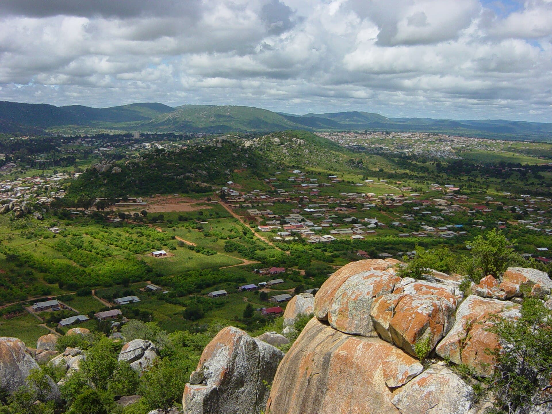
Iringa, TanzaniaMatt Crypto / Public domain, via Wikimedia Commons
TZ

Iringa

Self-guided audio walking tour of Iringa — GPS route, offline playback, story-driven narration in 32 languages.

Where ancient narratives meet the cool highland air, Iringa invites discovery.

The secrets of Iringa

Iringa, as no one tells it.

Not the postcards. The stories even locals don't know — whispered in your ear, right where they happened.

3 secrets below. Many more wait inside the tour.
Isimila Stone Age Site

Picture a landscape where early humans once walked, leaving behind tools that narrate a story spanning hundreds of thousands of years. The implements are not the only ancient marvel; the very earth here holds a geological secret.

Full story unlocks in the tour
Gangilonga Rock

This commanding granite formation, surveying Iringa, is known in the Hehe language as 'the talking stone.' This is not merely a poetic designation; an intriguing acoustic phenomenon lies beneath the name.

Full story unlocks in the tour
Iringa Boma

This seemingly modest building at Iringa's core possesses a remarkable past, transforming from a site of contention to a hub for cultural preservation.

Full story unlocks in the tour
The full tour

Discover every secret of Iringa

Every address, every reveal in full — in your ear, right where it happened.

Get the key to Iringa

You pick your stops. You walk. The voice reveals what the others miss.

Iringa — green trees on brown grass field near mountain during daytime
Photo: MARIOLA GROBELSKA / Unsplash
Iringa — group of people standing on green grass field during daytime
Photo: Ramon Sanchez Orense / Unsplash
Iringa — black jeep wrangler on dirt road during daytime
Photo: Ashim D’Silva / Unsplash
Choose your time

How long do you have in Iringa?

Your self-guided audio tour of Iringa is ready — pick your landmarks, choose your language, and start the moment you arrive.

Buy
About Iringa

The story of Iringa

Iringa, a city in Tanzania's Southern Highlands, offers a refreshing retreat with its moderate climate and profound cultural character. Resting on a hilltop, it provides expansive perspectives of the surrounding ridges and valleys, including the Little Ruaha River to the south. The city's designation, derived from the Hehe word 'lilinga,' meaning 'fortress,' alludes to its critical historical significance.

Beyond serving as a gateway to the immense Ruaha National Park, Iringa itself is a destination where history, nature, and local existence converge. From ancient archaeological sites to colonial-era architecture and lively markets, it presents a compelling synthesis of experiences for those seeking an authentic Tanzanian journey. The city's elevation, over 1,550 meters (5,090 ft) above sea level, contributes to its distinctly cooler temperatures compared to Tanzania's coastal areas, making it an appealing sanctuary.

History

Early Inhabitants and the Hehe Kingdom

The Iringa Region holds a deep history of human occupation, evidenced by the Isimila Stone Age Site, situated approximately 20 kilometers southwest of the city. This significant archaeological location contains stone tools and artifacts from human activity dating back an astonishing 70,000 to 100,000 years, with some implements even older, suggesting presence between 300,000 and 600,000 years ago. The tools, including hand axes, cleavers, and scrapers, offer insights into Middle Pleistocene hominid behavior in an area that was once a lake encircled by rivers, providing a rich environment for early humans and animals. Over time, geological forces, including erosion, sculpted the dramatic sandstone pillars that now stand as natural monuments to this ancient era.

German Colonial Era and Chief Mkwawa's Resistance

Iringa's more recent past is closely interwoven with the Hehe people, recognized for their determined stand against foreign intrusion. In the late 19th century, Chief Mkwawa led a tenacious resistance movement against German colonization. Following a notable defeat of German forces at Lugalo, the Germans established a military station at 'Neu Iringa' in the 1890s as a defensive position, aiming to control the strategically important Uhehe region and avenge their fallen commander. Mkwawa's stronghold and headquarters were located in the nearby village of Kalenga, which remains a significant historical location. The city of Iringa itself was established in 1896 when German Captain Tom von Prince created a fortified fort. This period saw the cultivation of crops like coffee and cotton in the Iringa highlands, often relying on forced labor.

Post-Colonial Development

After Germany's defeat in World War I, British troops occupied Iringa in 1916, assuming administration. The Iringa Boma, originally a German military hospital constructed in 1914, later served as a British administrative center. A significant symbolic event for the local populace occurred in 1954 with the ceremonial return of Chief Mkwawa's skull from Germany. Following Tanzania's independence in 1961, the Iringa Boma continued its function as regional and district administrative offices until 2014, before its transformation into a regional museum and cultural center in 2016.

What to see

Begin your exploration at the Isimila Stone Age Site, located about 20 kilometers southwest of Iringa. This archaeological marvel displays an extensive collection of Acheulean stone tools, some dating back hundreds of thousands of years, situated amidst dramatic, naturally eroded sandstone pillars. A small museum on-site provides context for the discoveries.

For sweeping views of Iringa and the surrounding landscape, ascend Gangilonga Rock. Known as the 'talking stone,' this granite formation holds cultural importance for the Hehe people and offers a memorable place for sunset viewing.

Delve into the city's colonial and cultural narrative at the Iringa Boma Regional Museum and Cultural Centre. Housed in a beautifully restored German-era building, the museum features exhibits on the Hehe people, historical photographs, and artifacts.

A short drive from Iringa, the village of Kalenga was the historical bastion of Chief Mkwawa and the Hehe people during their resistance against German colonial rule. The Chief Mkwawa Museum in Kalenga preserves relics and information about this revered leader.

The lively Iringa Central Market offers a deep immersion into local life, with a variety of goods, fresh produce, and local crafts. For those interested in local artistry and social enterprises, Neema Crafts Centre is a notable stop, offering workshops and a cafe.

When to visit

The ideal time to experience Iringa is during the dry season, which extends from June through October. During these months, temperatures are mild, and rainfall is minimal, making it perfect for exploring the city and its nearby attractions. The dry season also provides the best conditions for observing wildlife in the adjacent Ruaha National Park, as animals gather around diminishing water sources. While the wet season (December to April) brings verdant landscapes, it also means more rain and potentially less accessible roads for certain activities.

Practical

Iringa is generally considered secure for travelers, though standard precautions such as safeguarding belongings and avoiding isolated areas after dark are advisable. Local transportation within Iringa is readily available via dala-dalas (small passenger buses), bajajis (three-wheeled auto-rickshaws), and bodabodas (motorcycles). Bajajis are a popular and economical choice, but it is prudent to agree on the fare before commencing your journey. Long-distance buses connect Iringa to major cities like Dar es Salaam, Dodoma, and Mbeya, with the main Igumbilo bus terminal located approximately 10 kilometers from the city center. For those preferring air travel, Nduli Airport (HTIR) serves Iringa with flights from Dar es Salaam. The local currency is the Tanzanian Shilling (TZS), and while larger hotels may accept cards, carrying cash is recommended for most transactions. Learning a few basic Swahili phrases can enrich interactions with the welcoming locals.

Good to know
What is Iringa known for?
Iringa is recognized for its cool highland climate, its deep history connected to the Hehe people and their stand against German colonial rule, and as a gateway to Ruaha National Park, one of Africa's most expansive national parks.
Is Iringa safe for tourists?
Iringa is generally considered secure for travelers. It is wise to observe standard safety measures such as keeping personal items safe, avoiding solitary areas at night, and utilizing registered taxis or trusted transportation.
What is the best way to get around Iringa?
Within Iringa town, popular and affordable transport options include *dala-dalas* (mini-buses), *bajajis* (three-wheeled auto-rickshaws), and *bodabodas* (motorcycles). For longer distances, buses are a common choice, and taxis are also available.
What language is spoken in Iringa?
The primary languages spoken in Iringa are Swahili and English. Acquiring a few basic Swahili phrases can be beneficial and is often appreciated by local residents.
What is the currency used in Iringa?
The official currency in Iringa, and throughout Tanzania, is the Tanzanian Shilling (TZS). While some larger establishments may accept credit cards, it is advisable to carry cash for most transactions.
Are there any cultural etiquette tips for visiting Iringa?
When visiting Iringa, it is respectful to dress modestly, particularly when visiting religious sites or engaging with local communities. Learning some basic Swahili phrases can also help foster positive interactions.
On the map
Iringa
From€9.90
No booking · activate anytime · 12h to walk it
Get the key to Iringa