Saguenay Fjord
The Saguenay Fjord holds a secret in its depths, a unique layering of water that sustains two distinct ecosystems.
Full story unlocks in the tour
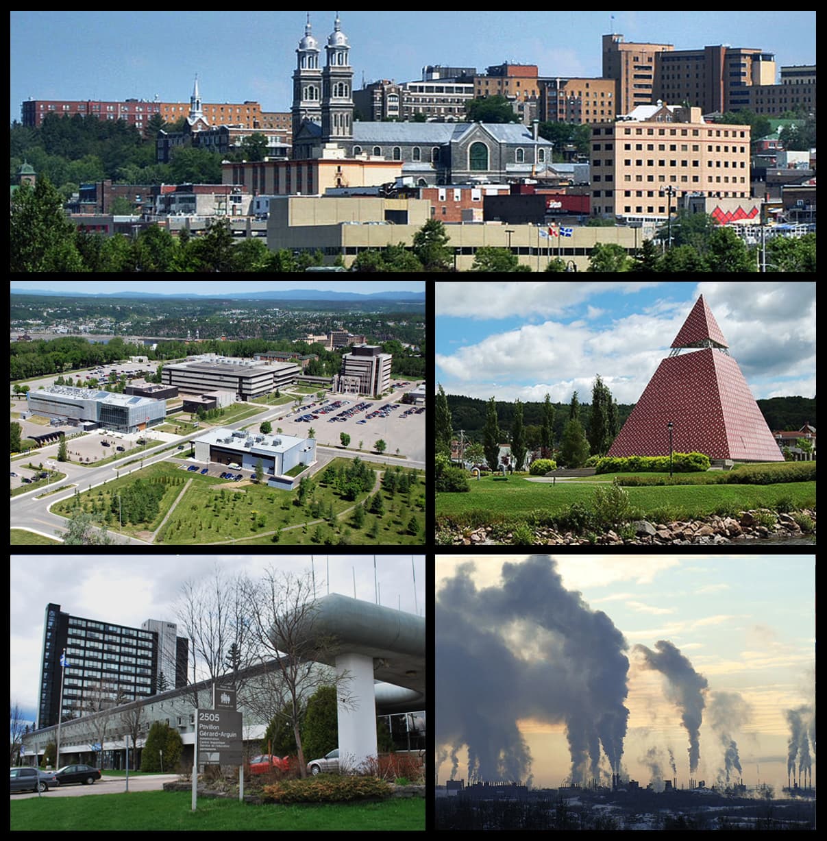 Chicoutimi_-_Centre-ville_Est.jpg: Chicoutimi CampusUQAC07_282.JPG: service des communications de l'UQAC Pyramide_des_Ha!_Ha!.jpg: Adqproductions Entrée_du_pavillon_Gérard-Arguin_du_Cégep_de_Jonquière02.JPG: Khayman 20090111_Alcan_secteur_Arvida.JPG: Khayman derivative work: Chicoutimi (talk) / CC BY-SA 3.0, via Wikimedia Commons
“Where a freshwater river meets a saltwater fjord, creating a world of its own.”
Not the postcards. The stories even locals don't know — whispered in your ear, right where they happened.
The Saguenay Fjord holds a secret in its depths, a unique layering of water that sustains two distinct ecosystems.
This museum, housed in a former pulp mill, bears the scars of a natural disaster that reshaped the region.
The name of this bay, a prominent feature of the Saguenay Fjord, isn't an expression of laughter.
Discover every secret of Saguenay
Every address, every reveal in full — in your ear, right where it happened.
You pick your stops. You walk. The voice reveals what the others miss.
No tours available yet. Check back soon — we're preparing them.
Saguenay, Quebec, is a city forged by the dramatic landscapes surrounding it, most notably the Saguenay Fjord. This singular geological marvel, stretching 105 kilometers from Saint-Fulgence to Tadoussac, is one of the longest and southernmost fjords in the world. Carved by glaciers during the last ice age, the fjord features cliffs reaching up to 350 meters and depths of 270 meters, creating a striking natural boundary where a freshwater river meets the salty embrace of the St. Lawrence Estuary.
More than just a geological wonder, Saguenay is a region where nature and industry have long intertwined. The city itself was formed in 2002 by amalgamating several smaller communities, including Chicoutimi, Jonquière, and La Baie, each with its own distinct character and history. From its early days as a fur trading post to its later development as a center for logging, pulp and paper, and aluminum production, Saguenay's identity has been shaped by its abundant natural resources and the ingenuity of its people.
The history of the Saguenay region stretches back thousands of years, with the Indigenous Innu people inhabiting the lands along the fjord, utilizing the river as a vital transportation route. European presence began in 1676 with the establishment of a fur trading post in Chicoutimi, which served as a crucial center for the trade. For nearly two centuries, from 1652 to 1842, the territory was designated exclusively for the fur trade, with only traders and missionaries permitted entry.
Large-scale colonization commenced in 1838 when the "Society of the Twenty-One" (Société des Vingt-et-un), a group of investors and settlers, arrived in the Grande-Baie area (now La Baie) to initiate logging operations. The official opening of the Saguenay to lumbering and agriculture occurred in 1842. William Price, an English-born entrepreneur, played a pivotal role in the region's development, founding a logging empire that laid the economic groundwork for future towns. The early 20th century saw rapid industrialization, driven by the region's hydroelectric potential and vast boreal forests. Between 1925 and 1928, the world's largest aluminum plant was constructed, alongside the city of Arvida. By 1942, Alcan built the Shipshaw hydroelectric station, which was the largest in the world at the time, to power the plant.
The modern city of Saguenay was officially formed on February 18, 2002, through the amalgamation of Chicoutimi, Jonquière, La Baie, Laterrière, and parts of other municipalities. This consolidation brought together communities shaped by distinct industrial histories, from Chicoutimi's origins as a trading post and lumber town to Jonquière's growth around pulp and paper mills and Arvida's development as an aluminum production center. The region's deep-water fjord provided direct access to the sea, facilitating the export of resources and the import of raw materials, which was crucial for its industrial growth.
The Saguenay Fjord National Park is a primary draw, offering dramatic landscapes of towering cliffs and deep waters. Visitors can explore over 100 kilometers of hiking trails, go sea kayaking, or take a boat tour to fully appreciate the fjord's scale. The Baie-Sainte-Marguerite sector is particularly renowned for beluga whale watching in the summer. For those seeking adventure, Parc Aventures Cap Jaseux provides aerial courses, via ferrata, and singular accommodations like treehouses.
In the city, La Pulperie de Chicoutimi / Regional Museum offers a glimpse into the area's industrial past, housed in a former pulp mill. The Monts-Valin National Park, a short drive from Chicoutimi, is a year-round destination for hiking, fishing, and paddleboarding, transforming into a winter wonderland for snowshoeing and skiing. The picturesque village of Sainte-Rose-du-Nord provides expansive fjord views and opportunities for sea kayaking and cruises.
Saguenay is a year-round destination, with activities catering to every season. For warm-weather pursuits like hiking, kayaking, and whale watching, the best time to visit is from early July to late August. Whale watching season typically runs from May to October. Winters are long and cold, with January being the coldest month, but they offer a magical landscape for snowmobiling, ice fishing, snowshoeing, and skiing. Expect consistent precipitation throughout the year, so be prepared for some wet weather regardless of your visit.
The currency used in Saguenay, and throughout Canada, is the Canadian Dollar (CAD). Credit and debit cards are widely accepted, but carrying some cash is advisable for smaller purchases or remote areas. Tipping between 15% to 20% is standard for restaurant and taxi services. French is the predominant language in the region. Saguenay is considered a very safe city with low crime rates.
Saguenay-Bagotville Airport (YBG) is the most convenient option for air travelers, located approximately 12 kilometers from the city center in the borough of La Baie. Taxis and shuttles are available from the airport. Within the city, public transportation is available, and Saguenay is increasingly bike-friendly during the summer months, with a network of cycle paths and a Vélobus service.