German Steam Locomotive No. 41
A seemingly ordinary steam engine in the town center holds a surprising tale of thirst and early railway mishaps.
Full story unlocks in the tour
 Ji-Elle / CC BY-SA 4.0, via Wikimedia Commons
Self-guided audio walking tour of Otjiwarongo — GPS route, offline playback, story-driven narration in 32 languages.
“Where the 'fat cattle' roam, and cheetahs find refuge.”
Not the postcards. The stories even locals don't know — whispered in your ear, right where they happened.
A seemingly ordinary steam engine in the town center holds a surprising tale of thirst and early railway mishaps.
This dramatic plateau, a short drive from Otjiwarongo, is not just a natural wonder but also a silent witness to a pivotal, tragic moment in Namibian history.
The town's name, 'Otjiwarongo,' hints at a long-standing agricultural tradition that shaped its very identity.
Discover every secret of Otjiwarongo
Every address, every reveal in full — in your ear, right where it happened.
You pick your stops. You walk. The voice reveals what the others miss.
Your self-guided audio tour of Otjiwarongo is ready — pick your landmarks, choose your language, and start the moment you arrive.
BuyOtjiwarongo, often called the “Cheetah Capital of the World,” is a significant town in central-north Namibia, serving as the administrative capital of the Otjozondjupa Region. Its name, derived from the Herero language, translates to 'the beautiful place' or 'the place where fat cattle graze,' a testament to its long-standing agricultural heritage. The town is strategically located on the B1 road, Namibia's primary transport artery, connecting the capital Windhoek to the north and serving as a crucial stopover for travelers heading to iconic destinations like Etosha National Park.
Beyond its role as a commercial and logistical hub for the surrounding cattle ranching industry, Otjiwarongo has carved out an identity deeply intertwined with wildlife conservation. It acts as a gateway to several world-renowned conservation projects, particularly those focused on large carnivores like the cheetah. The town offers a peaceful environment with well-maintained infrastructure, including supermarkets, banks, lodges, and hotels, making it a convenient and welcoming base for exploring the natural beauty and conservation efforts of central Namibia.
The area around Otjiwarongo has a history stretching back centuries, with the San and Damara peoples being its first known inhabitants. The Damara, specifically from the Geio-Daman clan, lived in the region as early as 1390 and even named the city ǂKhanubes. The Herero people, who moved into the area in the early 19th century, gave Otjiwarongo its current name, which means 'the place of the fat cattle' or 'beautiful place' in their language, reflecting the fertile grazing lands and abundant water sources that made it ideal for livestock.
The modern town of Otjiwarongo was officially established in 1900 with the arrival of a German colonial administration. A Rhenish (German Lutheran) mission station had already been established in the area in 1891. However, the most pivotal event in its early development was the arrival of the railway in 1906. The German colonial government extended the railway line from Swakopmund on the coast into the interior, and the establishment of a station at Otjiwarongo transformed it into a key transport and logistical hub. This infrastructure development spurred its growth as an administrative and commercial center for German farmers settling in the region. The German influence is still visible in some of the town's architecture and cultural practices.
The early 20th century also marked a dark period in the region's history. Between 1904 and 1907, a bloody war was fought between the Herero people and the Germans, culminating in the Battle of Waterberg in 1904, where many Herero people died. This tragic conflict led to the Herero and Namaqua Genocide. After World War I, Namibia came under South African administration, and the railway network, including lines through Otjiwarongo, was operated by South African Railways.
Throughout the 20th century, Otjiwarongo continued to grow as a center for the cattle ranching industry and an important stop on the country's main north-south road and rail lines. Following Namibian independence in 1990, the town has maintained its role as a regional capital. In recent decades, its identity has been significantly shaped by its proximity to world-renowned wildlife conservation projects, particularly those focused on cheetahs, earning it the moniker 'Cheetah Capital of the World.'
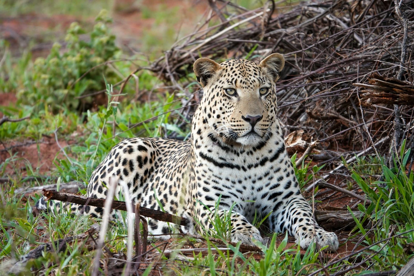
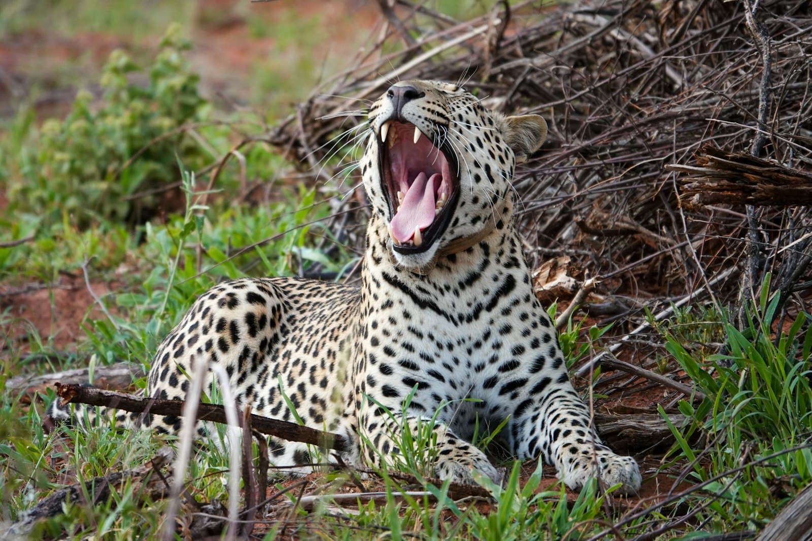
Otjiwarongo offers a blend of wildlife conservation, historical insights, and natural beauty. At the forefront of its attractions are the renowned Cheetah Conservation Fund (CCF) and Okonjima Nature Reserve, home of the AfriCat Foundation. Both organizations are dedicated to the research, rehabilitation, and long-term survival of cheetahs and leopards, offering educational tours, feeding sessions, and opportunities to observe these magnificent animals up close.
Just a short drive southeast of town lies the dramatic Waterberg Plateau Park. This majestic geological formation, rising high above the Kalahari plains, is a haven for diverse wildlife, including endangered species like black rhino, roan, and sable, which were relocated here for protection. Visitors can enjoy scenic hikes, guided game drives, and panoramic views from the plateau. The park also holds significant historical importance, being the site of the 1904 Battle of Waterberg.
Within Otjiwarongo itself, you can visit the Otjiwarongo Crocodile Ranch, one of the few captive breeding programs for the Nile Crocodile registered with CITES, where you can learn about crocodile farming and conservation. For a glimpse into the town's colonial past, seek out the German Steam Locomotive No. 41, a historic engine displayed in the town center that once operated on the Swakopmund to Otavi railway line. The Franke Tower, built in honor of German colonial officer Major Viktor Franke, also offers insights into this period and views over the town. For those interested in ancient history, Paula's Cave in the nearby mountains features ancient rock art. The town's local markets provide an opportunity to experience authentic culture and purchase traditional crafts.
The best time to visit Otjiwarongo and the surrounding central Namibia region is during the dry winter season, which runs from May to September. During these months, temperatures are generally mild and comfortable, with clear, sunny skies and a low chance of rain. This period is ideal for wildlife viewing, as animals congregate around permanent water sources due to the scarcity of rainfall, making them easier to spot. While days are warm, nights can be chilly, especially in the desert areas, so packing layers is advisable. The shoulder months of April and October also offer pleasant weather with potentially fewer crowds.
Otjiwarongo is well-connected and relatively easy to navigate. It sits on the B1 national road, the main north-south artery of Namibia, making it accessible by car from Windhoek (approximately 250 km south). The town also has a landing strip for light aircraft, located about 5 km north of town on the B1. Public transport options include daily bus services and shared taxis connecting to various towns across Namibia.
Getting around Otjiwarongo itself is straightforward. The town center is compact and can be explored on foot. For longer distances within town or to surrounding attractions, local taxis are readily available. If you prefer independent travel, car hire companies operate in Namibia, with Avis having an office in Otjiwarongo. Parking is generally free.
Otjiwarongo offers a range of facilities, including supermarkets, banks, lodges, and hotels, catering to travelers' needs. It serves as a good base for stocking up on supplies before venturing further into northern Namibia.