Morro da Igreja
Urubici détient le record brésilien de la température la plus basse jamais enregistrée.
L'histoire complète se débloque dans le tour
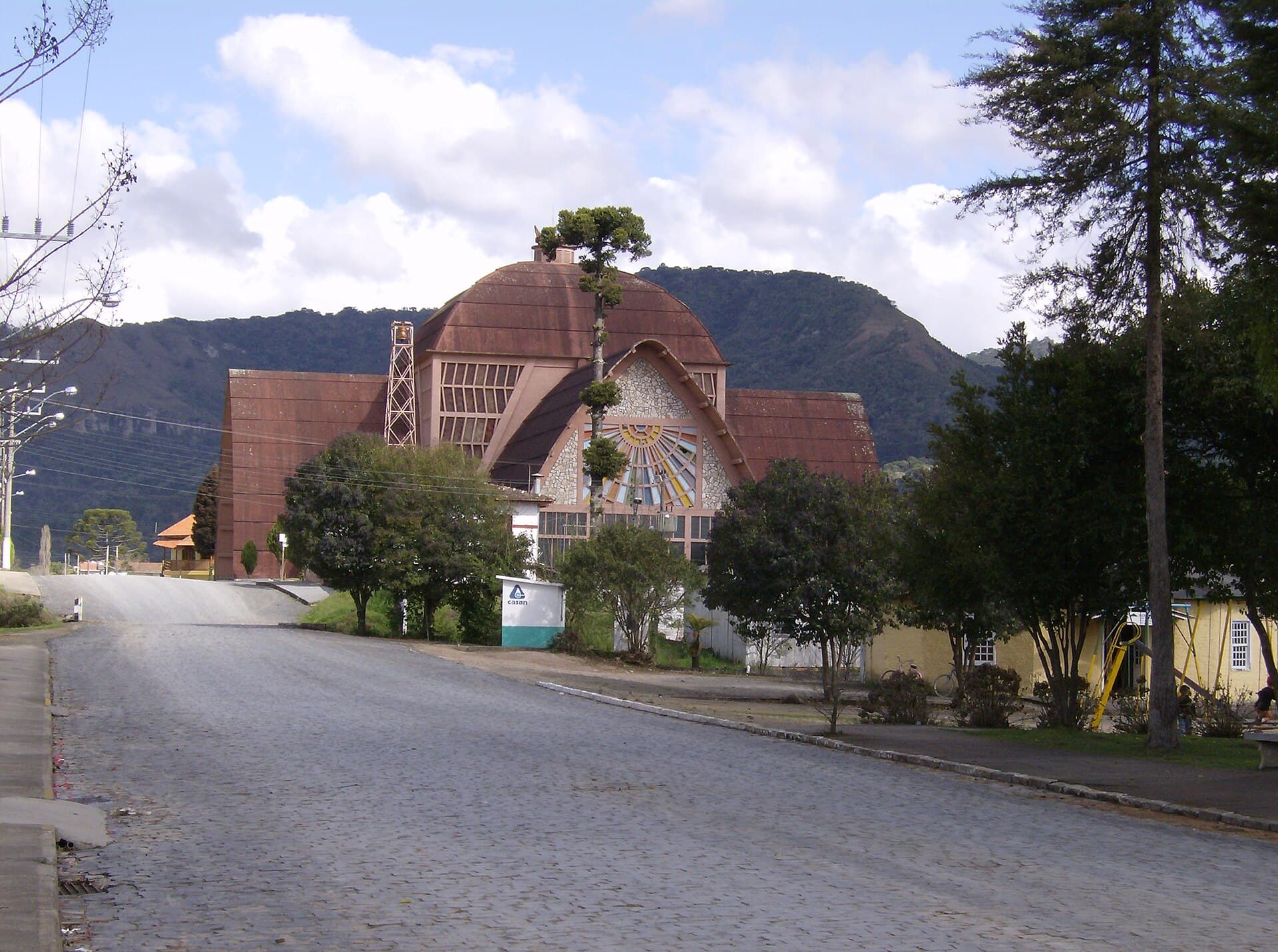 Scheridon / CC BY-SA 3.0, via Wikimedia Commons
Visite audio autoguidée de Urubici — parcours GPS à pied, lecture hors ligne, narration en 32 langues.
“Là où les canyons rencontrent les nuages et les murmures anciens résonnent à travers les forêts d'Araucaria.”
Pas les cartes postales. Les histoires que même les habitants ignorent — soufflées à l'oreille, là où elles se sont passées.
Urubici détient le record brésilien de la température la plus basse jamais enregistrée.
Un col de montagne spectaculaire présente ici la plus grande découpe de grès du Brésil.
Les anciens habitants ont laissé leur empreinte sur le paysage il y a des milliers d'années.
Découvrez tous les secrets de Urubici
Chaque adresse, chaque révélation en entier — dans ton oreille, là où elle s'est passée.
Tu choisis tes lieux. Tu marches. La voix te révèle ce que les autres ignorent.


Votre visite audioguidée de Urubici vous attend — choisissez vos lieux, votre langue, et lancez-vous dès votre arrivée.
AcheterLume intègre un guide en réalité augmentée. Levez votre téléphone : sa caméra montre la rue devant vous, avec une flèche lumineuse posée sur l'image réelle qui pointe toujours vers votre prochain arrêt — aucune carte à déchiffrer, aucun mauvais virage. Comme tout dans Lume, ça fonctionne entièrement hors-ligne.
Urubici, une municipalité captivante de l'État de Santa Catarina, au Brésil, offre un contraste saisissant avec les plages célèbres et les jungles tropicales du pays. Située dans la chaîne de montagnes de la Serra Catarinense, à environ 160 kilomètres de Florianópolis, cette charmante ville se trouve à une altitude d'environ 915 mètres et est réputée pour son climat frais et sa beauté naturelle frappante. C'est une destination où les collines ondulantes, les canyons profonds et les immenses forêts d'Araucaria définissent le paysage, attirant les visiteurs en quête d'écotourisme et d'aventure.
Le climat distinct de la région, qui comprend des chutes de neige occasionnelles en hiver, en fait l'une des destinations les plus uniques du Brésil. L'attrait d'Urubici réside dans ses diverses activités de plein air, allant de l'exploration de cascades impressionnantes et de points de vue panoramiques à la randonnée à travers les parcs nationaux. La ville, nichée dans la vallée de la rivière Canoas, sert de porte d'entrée au parc national de São Joaquim, une zone riche en flore et en faune, renforçant ainsi son attrait pour les amoureux de la nature.
La région englobant Urubici fut initialement habitée par des populations indigènes pendant des milliers d'années, laissant derrière elles un héritage de gravures rupestres précolombiennes comme preuve de leur présence. Ces anciens pétroglyphes, certains datant de quatre millénaires, se trouvent dans des zones telles que les Gardiens d'Avencal et la Caverna Rio dos Bugres, fournissant des informations historiques inestimables sur les premiers habitants. Les sites archéologiques de la région d'Urubici, principalement situés dans la fertile vallée de la rivière Canoas, indiquent une occupation par le peuple proto-Jê d'environ 300 après J.-C. à la période coloniale vers 1700 après J.-C.
La colonisation européenne de la région a commencé entre 1903 et 1911 avec l'arrivée de colons agriculteurs et de bûcherons. Une vague importante d'immigrants italiens, allemands et lettons a suivi en 1924, attirés par le sol fertile de la vallée de la rivière Canoas. Ces immigrants ont établi l'agriculture et l'élevage comme piliers de l'économie locale, façonnant le développement de la région. Urubici a été officiellement établie en tant que district de São Joaquim en 1922 et a obtenu le statut de municipalité indépendante le 6 décembre 1956, avec son incorporation le 3 février 1957. Au cours de son histoire, la culture, les arts, l'architecture et la cuisine d'Urubici ont été influencés par les colons portugais, italiens, allemands, africains et lettons. Aujourd'hui, l'économie locale continue d'être basée sur l'agriculture et le tourisme. La ville est un producteur majeur de légumes à Santa Catarina et est également connue pour la culture de la pomme et du maté.
Le paysage d'Urubici est une toile de merveilles naturelles, offrant une variété de sites. Le Morro da Igreja est une attraction majeure, culminant à 1 822 mètres et offrant des vues imprenables, y compris l'emblématique Pedra Furada, une formation rocheuse naturelle avec un grand trou. L'accès au Morro da Igreja et à la Pedra Furada, situés dans le parc national de São Joaquim, nécessite une réservation préalable via le site web de l'ICMBio.
Un autre arrêt essentiel est la Serra do Corvo Branco, un col de montagne célèbre pour son impressionnante découpe de grès de 90 mètres, la plus grande du Brésil. À proximité, le Parque Altos do Corvo Branco offre cinq points de vue, dont des plateformes en verre, pour des panoramas exceptionnels. Pour les amateurs de cascades, la Cascata do Avencal est une destination incontournable, avec ses eaux plongeant sur plus de 100 mètres. La Cascade du Voile de la Mariée (Véu de Noiva Waterfall) est une autre cascade pittoresque, où les eaux descendent gracieusement sur de grandes pierres. Le Morro do Campestre est connu pour ses formations naturelles de grès et offre une vue privilégiée sur la vallée de la rivière Canoas, particulièrement prisée pour l'observation du coucher de soleil.
Au-delà de ceux-ci, explorez les Inscriptions Rupestres d'Urubici, d'anciens pétroglyphes qui témoignent du passé indigène de la région. La Gruta Nossa Senhora de Lourdes est une grotte naturelle présentant des formations rocheuses uniques. Pour une perspective différente, considérez le Cânion Espraiado, une destination pour les sentiers et la randonnée, offrant des vues sur d'immenses falaises.
Urubici est une destination que l'on peut apprécier toute l'année, chaque saison offrant une expérience différente. L'hiver, de juin à août, est particulièrement populaire pour ses températures fraîches, ses matins brumeux et la rare chance de neige, ce qui en fait une expérience brésilienne unique. Les températures diurnes en hiver sont en moyenne d'environ 9°C à 10°C, avec des nuits plus froides. L'été, de décembre à février, apporte un temps plus chaud avec des températures diurnes allant de 17°C à 27°C, bien que ce soit aussi la saison la plus pluvieuse. Le printemps (septembre à novembre) et l'automne (mars à mai) offrent des températures plus douces et sont généralement considérés comme des périodes agréables pour visiter, le printemps apportant des fleurs sauvages en pleine floraison.
Pour atteindre Urubici, il est fortement recommandé de conduire car la plupart des attractions sont dispersées. La ville est à environ 160 kilomètres de Florianópolis, un trajet qui dure environ 3 heures. Bien que les routes principales soient généralement en bon état, certaines routes menant aux points de vue et aux cascades sont des chemins de terre non pavés ; cependant, un véhicule 4x4 n'est généralement pas nécessaire. Pour certaines attractions, comme Morro da Igreja et Pedra Furada dans le parc national de São Joaquim, les réservations à l'avance sont obligatoires via le site web de l'ICMBio, idéalement six jours avant votre visite. De nombreux points de vue et parcs sont sur des propriétés privées et peuvent facturer un droit d'entrée. Un séjour de 3 à 4 jours est recommandé pour découvrir les sites majeurs, des visites plus longues permettant une exploration plus approfondie des cascades et des sentiers de randonnée.
Urubici en coréen, en chinois ou en hébreu — et dans 29 autres langues, chaque étape narrée par une voix native. La plus large gamme de langues de tous les audioguides autoguidés.
Disponible en :