Iglesia San José
L'église principale de Cachi recèle un secret au sein même de sa structure.
L'histoire complète se débloque dans le tour
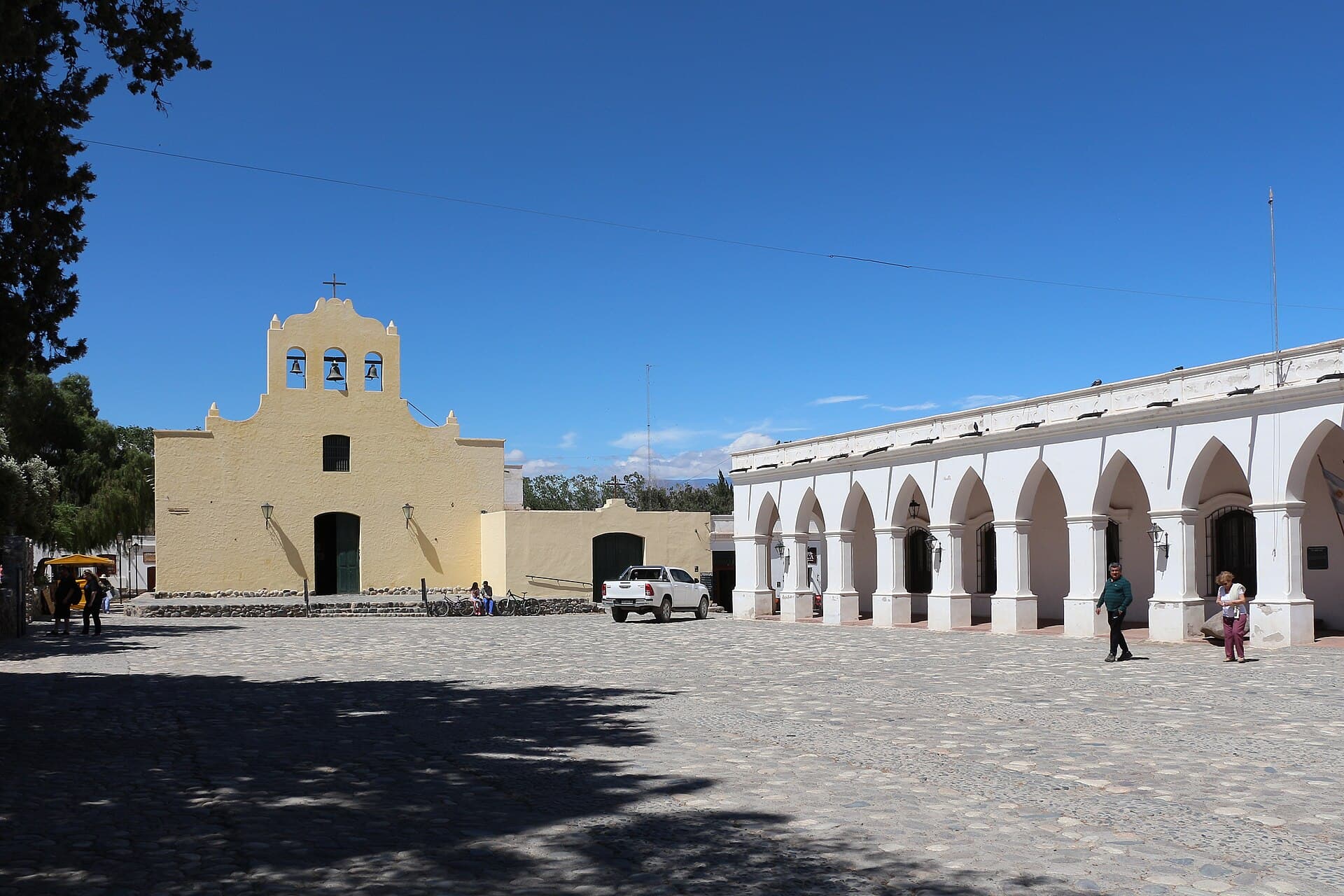 Bernard Gagnon / CC BY-SA 4.0, via Wikimedia Commons
Visite audio autoguidée de Cachi — parcours GPS à pied, lecture hors ligne, narration en 32 langues.
“Là où le temps ralentit et les montagnes murmurent des ères anciennes.”
Pas les cartes postales. Les histoires que même les habitants ignorent — soufflées à l'oreille, là où elles se sont passées.
L'église principale de Cachi recèle un secret au sein même de sa structure.
Le point culminant de la route spectaculaire menant à Cachi doit son nom à un objet égaré.
Le nom de la ville elle-même est un malentendu linguistique enraciné dans l'imposant Nevado de Cachi.
Découvrez tous les secrets de Cachi
Chaque adresse, chaque révélation en entier — dans ton oreille, là où elle s'est passée.
Tu choisis tes lieux. Tu marches. La voix te révèle ce que les autres ignorent.


Votre visite audioguidée de Cachi vous attend — choisissez vos lieux, votre langue, et lancez-vous dès votre arrivée.
AcheterLume intègre un guide en réalité augmentée. Levez votre téléphone : sa caméra montre la rue devant vous, avec une flèche lumineuse posée sur l'image réelle qui pointe toujours vers votre prochain arrêt — aucune carte à déchiffrer, aucun mauvais virage. Comme tout dans Lume, ça fonctionne entièrement hors-ligne.
Cachi, une ville sereine des vallées Calchaquíes en Argentine, offre une évasion tranquille au milieu de paysages andins spectaculaires. Située à environ 2 280 mètres (7 480 pieds) au-dessus du niveau de la mer, c'est un endroit où les maisons en adobe blanchies à la chaux avec des balcons traditionnels en bois bordent des rues étroites, préservant un caractère colonial. L'imposant Nevado de Cachi, un pic enneigé en permanence atteignant environ 6 380 mètres (20 932 pieds), domine l'horizon occidental, offrant une toile de fond majestueuse au village.
La vie à Cachi se déroule à un rythme délibéré, invitant les visiteurs à s'attarder sur sa paisible Plaza Mayor, ombragée par des palmiers et des orangers. Au-delà de la ville, les vallées Calchaquíes environnantes se déploient avec des paysages variés, des terres fertiles cultivées avec des vignobles et des poivrons aux vastes forêts de cactus et aux formations rocheuses inhabituelles. C'est une destination qui mêle une histoire durable à une beauté naturelle, offrant un aperçu d'un mode de vie plus lent et plus traditionnel dans le nord-ouest argentin.
## Des tribus anciennes aux avant-postes coloniaux L'histoire de Cachi remonte à l'époque précolombienne, bien avant l'arrivée des Espagnols. La région était à l'origine habitée par des peuples indigènes, notamment les tribus Diaguita et Calchaquí, qui ont laissé d'importants vestiges archéologiques. Leur influence continue de façonner les traditions locales et l'identité culturelle de la région.
Avec l'arrivée des Espagnols au XVIe siècle, Cachi est devenue un point stratégique pour les colonisateurs. Ses terres fertiles et son accès à d'importantes routes commerciales en ont fait une étape cruciale sur la route coloniale reliant la Vice-royauté du Pérou au Río de la Plata. Le passé colonial de la ville est clairement visible dans son architecture bien préservée, caractérisée par des maisons en adobe blanchies à la chaux, des rues étroites et de charmantes places. L'Iglesia San José, datant du XVIIIe siècle, témoigne de cette époque, présentant un mélange unique de styles architecturaux espagnols et indigènes.
## Un patrimoine vivant Aujourd'hui, Cachi continue d'être un lieu où l'histoire et la vie moderne s'entremêlent. Les agriculteurs cultivent toujours la terre selon des méthodes traditionnelles, et les artisans vendent leurs ponchos tissés et leurs poteries faites à la main à partir d'argile locale. Le musée archéologique Pío Pablo Díaz, situé en ville, abrite plus de 5 000 pièces couvrant 10 000 ans d'histoire préhispanique dans la vallée de Calchaquí, offrant un aperçu plus approfondi des civilisations anciennes qui y ont prospéré. La population de la ville, estimée à environ 9 541 habitants en 2026, a connu une croissance due à la fois à un taux de natalité élevé et à la migration d'autres villes argentines, mais elle conserve son caractère paisible et authentique.
Cachi offre un mélange de sites culturels et de merveilles naturelles. Commencez par la Plaza 9 de Julio, la place centrale de la ville, encadrée d'arbres et de jardins bien entretenus, et servant de cœur à la vie locale. Adjacente à la place se trouve l'Iglesia San José, une église du XVIIIe siècle remarquable pour sa construction unique, avec un plafond voûté, des autels et des confessionnaux fabriqués à partir de bois de cactus Cardón. Directement en face de la place, le musée archéologique Pío Pablo Díaz présente une vaste collection d'artefacts excavés localement, certains datant de 10 000 ans, détaillant l'histoire préhispanique de la vallée de Calchaquí.
Pour des vues imprenables, une montée au cimetière du village offre d'excellentes opportunités de photos de simples tombes en pierre sur fond de montagnes environnantes et de vallées verdoyantes. Au-delà de la ville, le Parc National Los Cardones est un arrêt crucial, caractérisé par ses vastes étendues de cactus géants et ses paysages désertiques spectaculaires. La route elle-même vers Cachi, en particulier le long de la Route Provinciale 33 à travers la Cuesta del Obispo et la Recta del Tin-Tin, est une expérience, offrant des vues mémorables sur des routes sinueuses et des formations rocheuses uniques. À proximité, le Valle Encantado (Vallée Enchantée) révèle des formes évocatrices dans ses roches sculptées par l'érosion éolienne et pluviale. Les amateurs de vin peuvent également explorer les caves locales comme Bodega Puna ou Miraluna, qui proposent des dégustations de vins Torrontés et Malbec d'altitude.
Les meilleures périodes pour visiter Cachi sont le printemps (septembre à novembre) et l'automne (mars à mai), lorsque le temps est doux et agréable. Les étés (décembre à février) peuvent être chauds, avec des maximales moyennes autour de 23°C (73°F), mais apportent également le plus de précipitations. Les hivers (juin à août) sont généralement ensoleillés mais peuvent être assez froids, avec des minimales moyennes autour de -2°C (28°F) à des altitudes plus élevées. La saison sèche, de mai à octobre, offre un ciel clair et moins de pluie, ce qui la rend idéale pour les activités de plein air.
Cachi est située à environ 2 280 mètres (7 480 pieds) au-dessus du niveau de la mer. Pour vous acclimater à l'altitude, il est conseillé de rester hydraté, d'éviter les activités intenses le premier jour et d'envisager d'apporter des médicaments contre le mal d'altitude si vous y êtes sujet. L'aéroport le plus proche est à Salta, à environ trois heures de route. Vous pouvez rejoindre Cachi en transfert privé, en voiture de location ou en bus. Louer une voiture offre la flexibilité d'explorer les routes panoramiques à votre rythme, bien que les routes de montagne puissent être difficiles pour les conducteurs inexpérimentés. Apportez suffisamment d'argent liquide, car les distributeurs automatiques peuvent être rares et parfois hors service. Emballez des vêtements légers et respirants pour la journée et des couches plus chaudes pour les soirées plus fraîches, car les températures peuvent varier considérablement. Des chaussures robustes, une protection solaire et une bouteille d'eau sont essentielles pour l'exploration en plein air.
Cachi en coréen, en chinois ou en hébreu — et dans 29 autres langues, chaque étape narrée par une voix native. La plus large gamme de langues de tous les audioguides autoguidés.
Disponible en :