Cono Volcánico de Çakallar
Imagina caminar por donde una vez pisaron humanos prehistóricos, dejando su huella no en piedra, sino en ceniza.
La historia completa se desbloquea en el tour
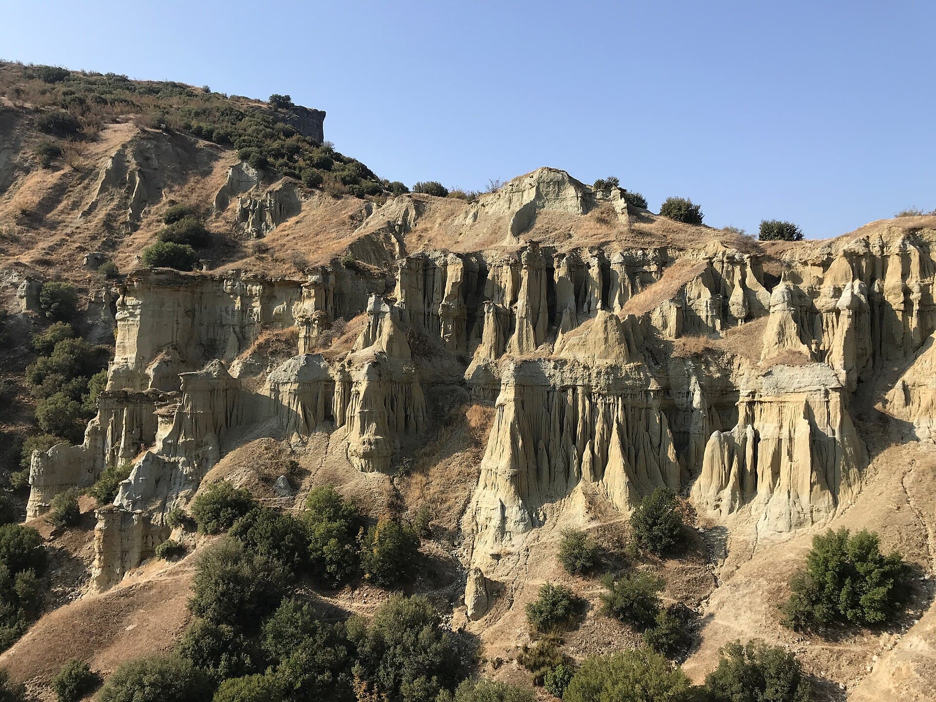 BSRF / CC BY-SA 4.0, via Wikimedia Commons
Tour de audio autoguiado de Kula — ruta GPS a pie, reproducción offline, narración en 32 idiomas.
“Donde antiguos flujos de lava se encuentran con el encanto otomano y la historia humana.”
No las postales. Las historias que ni los locales conocen — al oído, justo donde ocurrieron.
Imagina caminar por donde una vez pisaron humanos prehistóricos, dejando su huella no en piedra, sino en ceniza.
Adéntrate en el casco antiguo de Kula y quizás notes algo inusual en los tejados.
Hay un pueblo cerca de Kula donde una artesanía se ha transmitido durante siglos, utilizando métodos que preceden incluso a los otomanos.
Descubre todos los secretos de Kula
Cada dirección, cada revelación al completo — a tu oído, justo donde ocurrió.
Eliges tus paradas. Caminas. La voz te revela lo que los demás ignoran.


Tu tour de audioguía por Kula te espera — elige tus lugares, tu idioma y empieza al llegar.
ComprarKula, una ciudad interior en la región del Egeo Central de Turquía, ofrece un viaje cautivador a través del tiempo profundo y la historia humana. Es un lugar donde el pasado ardiente de la Tierra está visiblemente grabado en el paisaje, lo que le valió el antiguo apodo de 'Katakekaumene' o 'la tierra quemada' del geógrafo Estrabón. Este dramático terreno volcánico, caracterizado por campos de lava, rocas basálticas y más de 80 conos volcánicos, forma el núcleo del primer y único Geoparque Global UNESCO de Turquía, el Geoparque Global UNESCO Kula-Salihli.
Más allá de sus maravillas geológicas, Kula mantiene un barrio histórico notablemente conservado, un testimonio vivo de la arquitectura urbana otomana de los siglos XVIII y XIX. Aquí, los callejones estrechos están bordeados de casas tradicionales de dos pisos, algunas con 'tejados que se besan' que casi se tocan por encima, creando una atmósfera íntima y auténtica. Kula invita a los visitantes a explorar una mezcla única de espectáculo natural y patrimonio cultural, donde esperan huellas antiguas, artesanías tradicionales y una experiencia tranquila y observacional.
La historia de Kula está profundamente entrelazada con su dinámico entorno geológico. La actividad volcánica de la región comenzó hace unos 1,7 millones de años, con erupciones que continuaron hasta hace tan solo 2.600 años, dando forma a un paisaje que los autores antiguos, incluido Estrabón, describieron como 'Katakekaumene' o 'la tierra quemada'. Este carácter volcánico ha sido reconocido durante mucho tiempo, lo que convierte a Kula en un tema de interés para viajeros e investigadores durante siglos.
La presencia humana en este entorno volcánico activo se remonta a milenios. Cerca del cono de Çakallar, huellas humanas fosilizadas de hace aproximadamente 4.700–5.000 años proporcionan una rara evidencia de comunidades de la Edad del Bronce que se movían por la zona durante o después de las erupciones. Pinturas rupestres interpretadas como representaciones de cráteres en erupción y lava fluyendo ilustran aún más esta antigua interacción con el poderoso paisaje.
Durante la antigüedad, Kula fue conocida por varios nombres como Koloe, Opsukion, Clanudda, Katake y Kamene, lo que refleja su historia bajo el dominio de las antiguas Lidia, Persia, poderes helenísticos, romanos y bizantinos. Durante el período bizantino, Kula fue una posición fortificada, cambiando frecuentemente de manos entre las fuerzas bizantinas y turcas. La región quedó bajo dominio turco a principios del siglo XIV durante el período Germiyanid. En particular, Süleyman Şah, un gobernante Germiyanid, hizo de Kula su capital en 1388 después de ceder otros territorios a los otomanos como parte de una dote. El dominio otomano comenzó formalmente durante el reinado de Yıldırım Bayezid, y después de un regreso temporal al control Germiyanid tras la Batalla de Ankara en 1402, Kula fue anexada permanentemente al Estado Otomano en 1429, convirtiéndose en un subdistrito bajo el Sanjacado de Kütahya.
El centro histórico de Kula se erige como uno de los ejemplos mejor conservados de arquitectura urbana otomana de los siglos XVIII y XIX en Turquía. Sus casas tradicionales, con sus distintivos marcos de madera y pisos superiores salientes, ofrecen un vistazo a la vida social diaria de las ciudades otomanas. La ciudad también conserva rastros de su antigua población griega, con diseños neoclásicos dispersos, inscripciones griegas e insignias cristianas ortodoxas visibles en algunas áreas. Esta rica trama de historia geológica y humana culminó en el reconocimiento de Kula como el primer Geoparque Global UNESCO de Turquía en 2013, reconociendo su valor científico y cultural universal.
El principal atractivo de Kula es el Geoparque Global UNESCO Kula-Salihli, un vasto museo al aire libre de paisajes volcánicos. Comienza en el Centro de Visitantes del Geoparque para obtener una visión general y ver las huellas humanas de 4.000 años de antigüedad. Explora el Parque Volcánico Kula Divlit, donde puedes caminar por los flujos de lava basáltica tipo 'AA' de la fase volcánica más joven de Kula, un paisaje a menudo comparado con la luna. Observa las Chimeneas de Hadas de Kula, también conocidas como Kuladokya, formaciones únicas esculpidas por la erosión a partir de antiguos sedimentos lacustres.
Más allá de los campos volcánicos, adéntrate en el barrio histórico de Kula (Tarihi Kula Evleri), caracterizado por casas otomanas tradicionales con sus distintivos 'tejados que se besan'. Pasea por el bazar peatonal Yunus Emre Cd, donde las tiendas locales atienden las necesidades diarias, ofreciendo una visión auténtica de la vida de la ciudad. Visita la Mezquita Carullah Bin Süleyman en el pueblo de Emre, conocida por sus singulares pinturas murales de influencia occidental. Para probar la artesanía local, la Casa Dr. Aristi (Taller de Alfombras y Kilims de Kula), una histórica mansión griega, ahora exhibe las famosas alfombras y kilims tejidos a mano de Kula. Las Termas de Emir ofrecen la oportunidad de relajarse en aguas conocidas por sus propiedades curativas desde la época romana y otomana.
Las mejores épocas para visitar Kula son durante las temporadas intermedias: primavera (abril a mayo) y otoño (septiembre a octubre). Durante estos meses, las temperaturas son agradablemente cálidas, oscilando entre 21°C y 27°C (70°F a 81°F), lo que lo hace ideal para explorar los sitios geológicos y la ciudad histórica sin el intenso calor del verano. Las precipitaciones también son menores durante estos períodos en comparación con los meses de invierno. Los veranos (junio a agosto) pueden ser muy calurosos, con máximas que alcanzan los 35°C (95°F), lo que podría hacer que la exploración al aire libre sea incómoda. Los inviernos (noviembre a marzo) son más fríos y húmedos, con temperaturas que bajan a 1°C (34°F) por la noche y mayores precipitaciones.
Kula se encuentra en la provincia de Manisa, aproximadamente a 145 km al este de Izmir. El aeropuerto más cercano es el Aeropuerto Adnan Menderes de Izmir (ADB), a unas dos horas en coche. Desde Izmir, puedes llegar a Kula alquilando un coche, tomando un taxi o utilizando los servicios de autobuses interurbanos. Los servicios regulares de autobús conectan Kula con las principales ciudades turcas como Estambul, Ankara e Izmir, aunque algunas rutas pueden requerir un transbordo en Salihli. Aunque no hay conexión directa en tren, la estación de tren más cercana está en Manisa, desde donde puedes tomar un autobús o taxi a Kula.
Las opciones de alojamiento en Kula van desde hoteles modernos hasta casas turcas tradicionales bellamente restauradas, ofreciendo una variedad de experiencias. Considera alojarte en el distrito histórico para una experiencia inmersiva. Si bien Kula no es muy turística, se recomienda encarecidamente un coche para explorar la zona más amplia del geoparque.
Kula en coreano, en chino o en hebreo — y 29 idiomas más, cada parada narrada por una voz nativa. La mayor variedad de idiomas de cualquier audioguía autoguiada.
Disponible en: