Avenida de Honor de Afganistán
Un tranquilo monumento en Yungaburra guarda un sorprendente detalle sobre su origen.
La historia completa se desbloquea en el tour
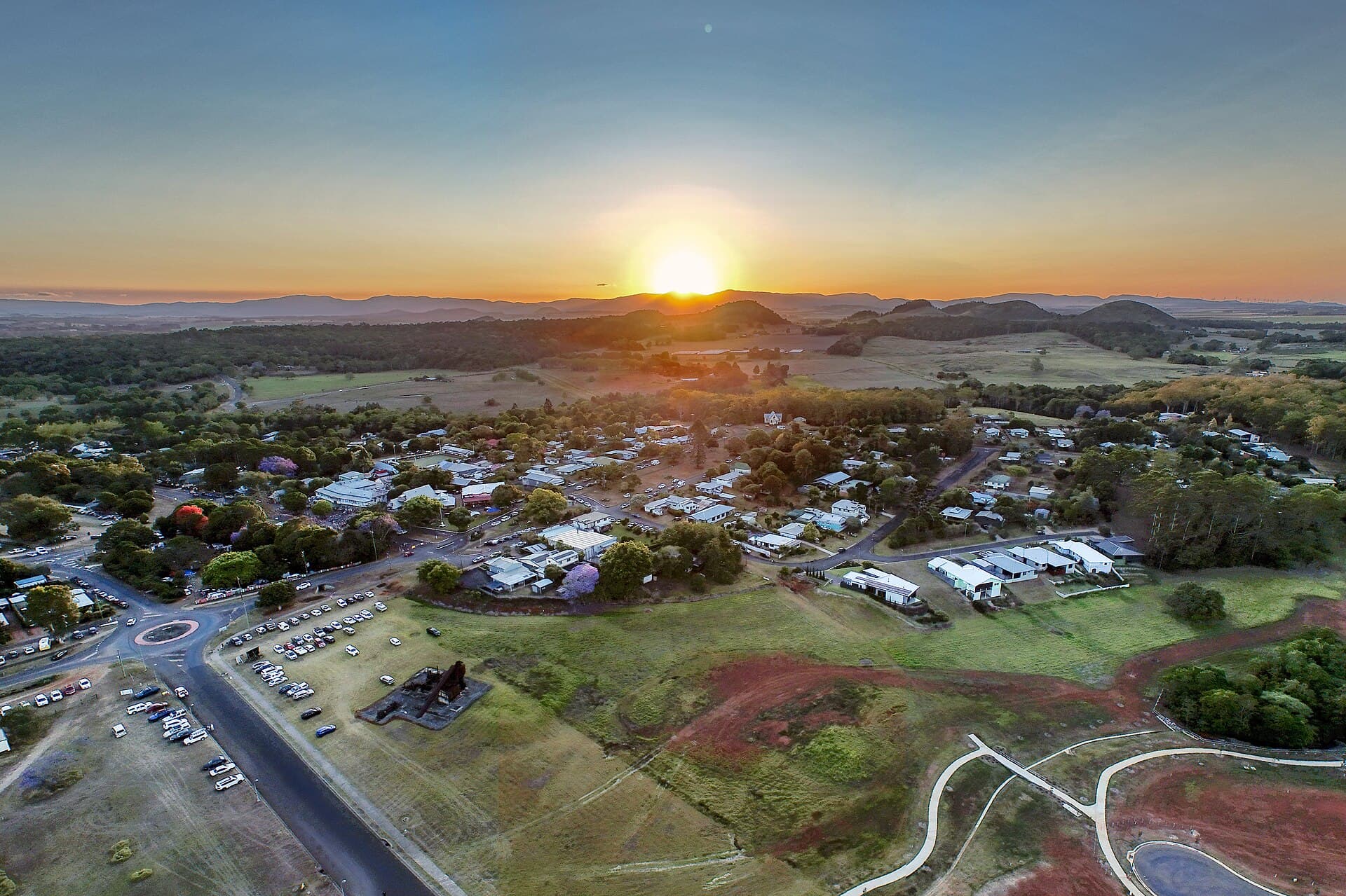 Hagai Agmon-Snir حچاي اچمون-سنير חגי אגמון-שניר / CC BY-SA 4.0, via Wikimedia Commons
Tour de audio autoguiado de Yungaburra — ruta GPS a pie, reproducción offline, narración en 32 idiomas.
“Donde antiguos volcanes esculpieron una tierra de belleza perdurable.”
No las postales. Las historias que ni los locales conocen — al oído, justo donde ocurrieron.
Un tranquilo monumento en Yungaburra guarda un sorprendente detalle sobre su origen.
Este antiguo gigante de la selva tropical logró su forma dramática a través de una notable inclinación botánica.
Un querido restaurante local fue regentado por un propietario que ofreció más que solo comidas durante décadas.
Descubre todos los secretos de Yungaburra
Cada dirección, cada revelación al completo — a tu oído, justo donde ocurrió.
Eliges tus paradas. Caminas. La voz te revela lo que los demás ignoran.


Tu tour de audioguía por Yungaburra te espera — elige tus lugares, tu idioma y empieza al llegar.
ComprarLume incluye una guía de realidad aumentada. Levanta el móvil y su cámara muestra la calle que tienes delante, con una flecha luminosa sobre la imagen real que siempre apunta a tu próxima parada — sin mapas que descifrar, sin giros equivocados. Como todo en Lume, funciona completamente sin conexión.
Yungaburra, un tranquilo pueblo en la meseta de Atherton en el Extremo Norte de Queensland, ofrece una cautivadora mezcla de maravillas naturales e historia preservada. Situado aproximadamente a 67 kilómetros al suroeste de Cairns, el pueblo se encuentra a una altitud de 720 metros (2,400 pies) sobre el nivel del mar, proporcionando un clima más fresco que las zonas costeras. El nombre 'Yungaburra' en sí mismo deriva del idioma aborigen Yidinyji, que significa 'lugar de encuentro' o 'lugar de investigación o cuestionamiento', lo que refleja su importancia histórica como punto de reunión para varios grupos indígenas antes del asentamiento europeo.
El paisaje que rodea Yungaburra es un testimonio de milenios de actividad volcánica, con las erupciones más recientes ocurriendo hace unos 10,000 años. Este pasado geológico ha esculpido una región de colinas verdes onduladas, antiguas selvas tropicales y distintivos lagos de cráter. Hoy en día, Yungaburra es reconocido por sus edificios catalogados como patrimonio, acogedores cafés y una fuerte conexión con su entorno natural, lo que lo convierte en una base popular para explorar las Mesetas de Atherton.
Los viajeros se sienten atraídos por Yungaburra no solo por su pintoresco entorno, sino también por sus oportunidades únicas para observar la vida silvestre y sus mercados locales. El pueblo mantiene una atmósfera relajada, con muchos de sus edificios conservando su esplendor original de principios del siglo XX. Es un lugar donde el pasado se siente presente, y el mundo natural siempre está a poca distancia a pie o en coche.
El área ahora conocida como Yungaburra se llamó originalmente 'Site Pocket' o 'Allumbah Pocket'. A principios de la década de 1880, sirvió como parada nocturna para mineros y colonos que viajaban desde la costa a los campos de estaño y oro más al oeste. La tierra alrededor de Site Pocket y el lago Eacham fue topografiada para asentamiento en 1886, con colonos que se mudaron para 1891. A estos primeros colonos se les asignaron parcelas de 40 acres, una mezcla de matorrales y bosques abiertos.
El establecimiento de un ferrocarril en 1910 fue un momento crucial para la floreciente comunidad. La estación de ferrocarril fue nombrada Yungaburra por el Departamento de Ferrocarriles de Queensland, y el pueblo mismo fue posteriormente renombrado Yungaburra para evitar confusiones con otro pueblo llamado Allumbah. Se cree que el nombre 'Yungaburra' proviene de la palabra local Yidinyji 'janggaburru', que se refiere al fresno plateado de Queensland, o, de manera más amplia, que significa 'lugar de encuentro' o 'lugar de investigación/cuestionamiento'.
Yungaburra ha conservado en gran medida su carácter desde 1910, con muchos de sus edificios en el corazón del pueblo manteniendo su estado original. El pueblo tiene la mayor proporción de edificios catalogados como patrimonio fuera de los centros regionales de Queensland, con 19 sitios incluidos en el Registro de Queensland para el National Trust of Australia. Este compromiso con la preservación permite a los visitantes experimentar un vínculo tangible con el pasado, evidente en la arquitectura histórica y las amplias galerías que bordean las calles. La Sociedad Histórica de Eacham ha investigado y publicado extensamente libros que detallan la historia de Yungaburra y las Mesetas de Atherton, ofreciendo una visión más profunda de las vidas de los pioneros que se asentaron aquí.
Antes del asentamiento europeo, el área alrededor de Yungaburra estaba habitada por aproximadamente 16 grupos indígenas diferentes, incluidos los Ngatjan y los Yidinji, quienes usaban el área para el comercio, el campamento y las ceremonias. La historia geológica de la región se remonta a millones de años, siendo la Meseta de Atherton una vez una profunda cuenca oceánica. Erupciones violentas y flujos de magma, particularmente hace unos 7 millones de años, dieron forma al paisaje, creando una densa capa de basalto. La actividad volcánica continuó intermitentemente, con cráteres explosivos conocidos como maars, como el lago Eacham y el lago Barrine, formándose tan recientemente como hace 10,000 años. Estas formaciones naturales, junto con la selva tropical mabi restante, resaltan la profunda y antigua historia de la tierra alrededor de Yungaburra.
Yungaburra ofrece una deliciosa variedad de lugares de interés, desde antiguas maravillas naturales hasta conmovedores monumentos y una activa cultura local. La Higuera de la Cortina es una magnífica higuera estranguladora que se estima tiene al menos 500 años. Un corto sendero accesible para sillas de ruedas conduce a este impresionante árbol, cuyas raíces aéreas caen 15 metros (49 pies) hasta el suelo del bosque, creando un dramático efecto de 'cortina'. El árbol se encuentra dentro de un remanente de la rara selva tropical mabi, ofreciendo un vistazo a este ecosistema en peligro.
Para aquellos que aprecian la vida silvestre, Peterson Creek es un lugar privilegiado para observar ornitorrincos, especialmente al amanecer y al anochecer. Una plataforma de observación dedicada proporciona un espacio tranquilo para observar a estas elusivas criaturas, y el paseo por Peterson Creek también ofrece la oportunidad de ver canguros arbóreos y varias especies de aves. La Avenida de Honor de Afganistán, un monumento viviente adyacente al lago Tinaroo, es un lugar para la reflexión, que honra a los soldados australianos que sirvieron en Afganistán. La avenida cuenta con árboles de fuego, un Tablero de Honor con placas para los soldados caídos y un monumento con piedras de Afganistán.
Más allá de estos sitios específicos, explore el pueblo mismo tomando el Circuito Histórico del Casco Antiguo, un mapa a pie que lo guía por los 18 edificios catalogados como patrimonio de Yungaburra, mostrando su arquitectura bien conservada de principios del siglo XX. Los Mercados de Yungaburra, que se celebran el cuarto sábado de cada mes (excepto diciembre), transforman el Bruce Jones Market Ground en un centro de productos locales, arte y artesanía. Cerca, el Parque Nacional de los Lagos de Cráter volcánicos ofrece oportunidades para nadar en el lago Eacham y caminar alrededor de los lagos Eacham y Barrine.
Yungaburra experimenta estaciones húmedas (diciembre a marzo) y secas (julio a septiembre) distintas. La mejor época para visitar para disfrutar de un clima agradable y hacer turismo es generalmente durante los meses de abril a septiembre. Durante este período, las temperaturas diurnas promedio oscilan entre 22°C y 26°C (72°F y 79°F), con menos precipitaciones, lo que lo hace ideal para actividades al aire libre y exploración. La estación seca, de mayo a noviembre, también se considera la ventana más popular para visitar las Mesetas de Atherton. Para observar la vida silvestre, particularmente los ornitorrincos, la estación seca (junio a octubre) puede ofrecer aguas de arroyo más claras y avistamientos potencialmente más fáciles, aunque son visibles durante todo el año, especialmente al amanecer y al anochecer.
Yungaburra es de fácil acceso, ubicado a aproximadamente una hora en coche al suroeste de Cairns a través de la pintoresca carretera Gillies. Alternativamente, se puede llegar al pueblo desde Innisfail a través de la carretera Palmerston o desde ciudades del norte como Kuranda o Port Douglas. El pueblo en sí es compacto y transitable a pie, especialmente para explorar los edificios históricos en el Old Town Loop.
Para aquellos que planifican su visita, el Centro de Información Turística (CIT) de Yungaburra, ubicado en Maud Kehoe Park, está abierto todos los días y cuenta con voluntarios expertos. Pueden ayudar con información local, reservas de tours y alojamiento, y proporcionar mapas y folletos gratuitos, incluido el folleto histórico de Yungaburra. El CIT también vende arte y artesanía hechos localmente, perfectos para recuerdos. Las opciones de alojamiento en Yungaburra y sus alrededores van desde moteles y bed and breakfasts en el pueblo hasta cabañas boutique y cabañas aisladas.
Al observar ornitorrincos en Peterson Creek, recuerde ser silencioso y quieto, y considere visitar al amanecer o al anochecer para tener la mejor oportunidad de avistamiento. La plataforma de observación tiene una sección accesible para sillas de ruedas. Para otras atracciones naturales como la Higuera de la Cortina, hay un corto paseo marítimo, también apto para sillas de ruedas.
Yungaburra en coreano, en chino o en hebreo — y 29 idiomas más, cada parada narrada por una voz nativa. La mayor variedad de idiomas de cualquier audioguía autoguiada.
Disponible en: